Low-pressure area intensifies into Depression heading towards Chennai!


Send us your feedback to audioarticles@vaarta.com


We already brought you the news that Chennai and three other districts in Tamil Nadu were issued Red Alert by the Indian Meteorological Department. More than 10 districts in the state were forecasted to have heavy rains today. Now, the latest news is that the low-pressure area has intensified into a depression and is likely to make landfall near Chennai.
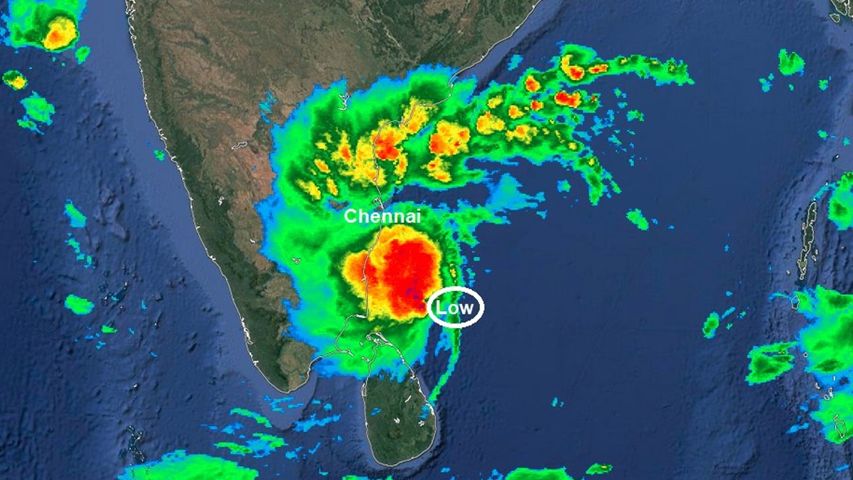
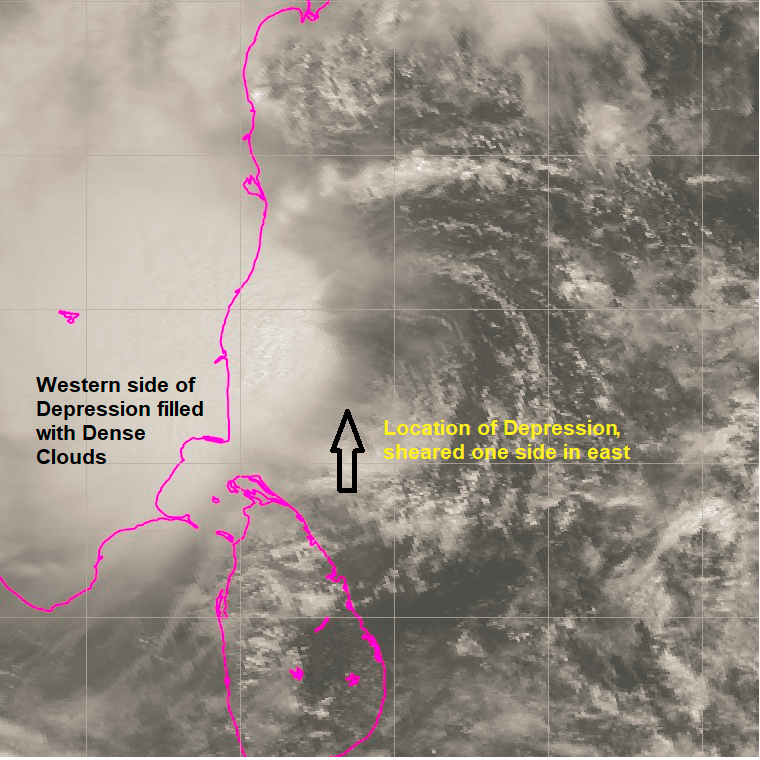
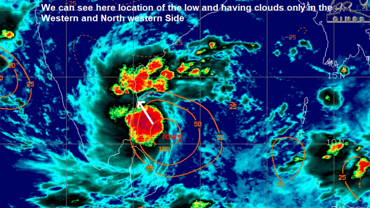
On November 18, the low-pressure area that originated in the Bay of Bengal is turned into a marginal cyclone. The intensified depression did not make much movement. The rains are getting delayed as the system is moving slow. Heavy rainfall is expected in the Chennai-Nellore belt and the big ball remains south east of Chennai with the low located far east of Cuddalore. Slowly the big cloud mass is shifting up towards NTN / KTC belt.

The chance for heavy rain is expected today for Chennai, Tiruvallur, Kancheepuram, Chengalpet, Villupuram, Vellore, Ranipet, Tirupattur, Tiruvannamalai and Cuddalore remains. All these districts have the possibility for heavy rains today morning to tomorrow morning. Since it is Depression next few hours we can see gusty winds in Chennai, till Depression is south of Chennai. Once Depression reaches the latitude, the winds will subside slowly.

Rains should happen before the low comes close to Chennai. For Chennai with this change, it has to rain in the day to tonight because once the depression moves up or west to close to our coast then our rains reduce and interior TN and South AP will get the rains. Massive rain bands fall over the Pondy-Cuddalore-Tiruvannamalai zone. The zone starting from Chengalpet till Vellore will also have a strong downpour. Pondicherry area has registered the most amount (115mm) of rainfall since 08.30 am.
As expected Depression is announced by the official agency. And a Chennai landfall again. 2nd one in just 1 week. Rains should happen before it comes close to chennai.
— Pradeep John (Tamil Nadu Weatherman) (@praddy06) November 18, 2021
Massive bands falls over Pondy-Cuddalore-Tiruvannamalai zone. Chengalpet joins party too & extends to Vellore. pic.twitter.com/Hls06KlKPg
Low intensifies and did not make my much movement towards Chennai-Nellore belt and the big ball remains south east of Chennai with the low located far east of Cuddalore. Slowly the big cloud mass is shifting up towards NTN / KTC belt.
— Pradeep John (Tamil Nadu Weatherman) (@praddy06) November 18, 2021
Detailed post - https://t.co/yv6sN3lBbc pic.twitter.com/0DabKPQFgK
Follow us on Google News and stay updated with the latest!
Comments
- logoutLogout

-
Nivika Shruthi
Contact at support@indiaglitz.com


 Follow


-a3e.jpg)
-3c4.jpg)
-e5c.jpg)
-e66.jpg)
-71b.jpg)
-5d5.jpg)
-adc.jpg)
-798.jpg)

-7c2.jpg)


